Pull three market reports on Willoughby Spit in the same week and you will get three different neighborhoods. One says the average home price fell by nearly a third year over year. Another, published the same month, says the three-month median actually climbed 16 percent. A third puts the median at $410,624, built from local agent data rather than portal aggregates. None of these sources are wrong. They are measuring the same few blocks of land and arriving at incompatible answers because Willoughby Spit is not one housing market wearing a single name. It is two, and the gap between them is about to get wider, not narrower.
If you are comparing Willoughby against other Hampton Roads neighborhoods on price alone, the median is the wrong number to anchor on. Here is what is actually driving it, and what a new city program means for anyone deciding whether this stretch of bayfront belongs on their shortlist.
One Name, Two Housing Stocks
Willoughby Spit is a thin peninsula between the Chesapeake Bay and Willoughby Bay, and its housing runs from one extreme to the other with almost nothing typical in between. On the low end, one-bedroom condominium units in older buildings have listed as low as $165,000. On the high end, newly constructed four-bedroom waterfront homes have listed as high as $1,429,000. A local agent working the area put the neighborhood's median at $410,624, a figure that sits closer to the new-construction end of the spectrum than to the fixer-condo end, which tells you something about which properties are actually moving.
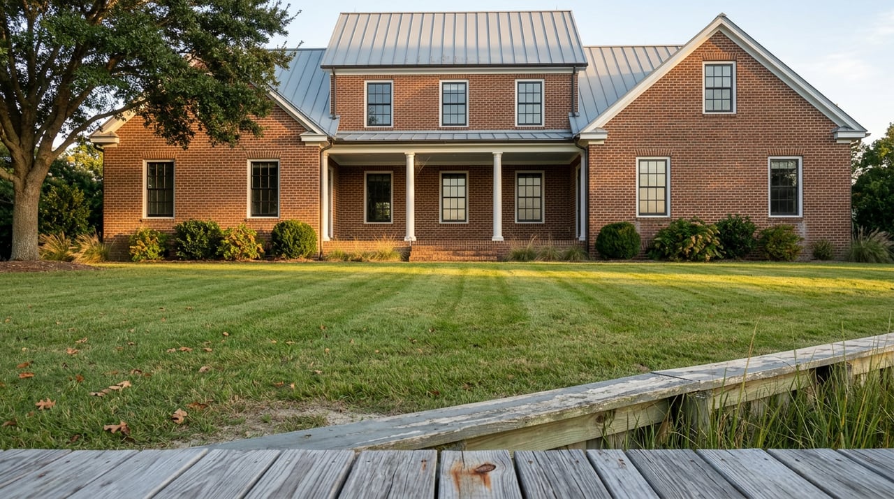
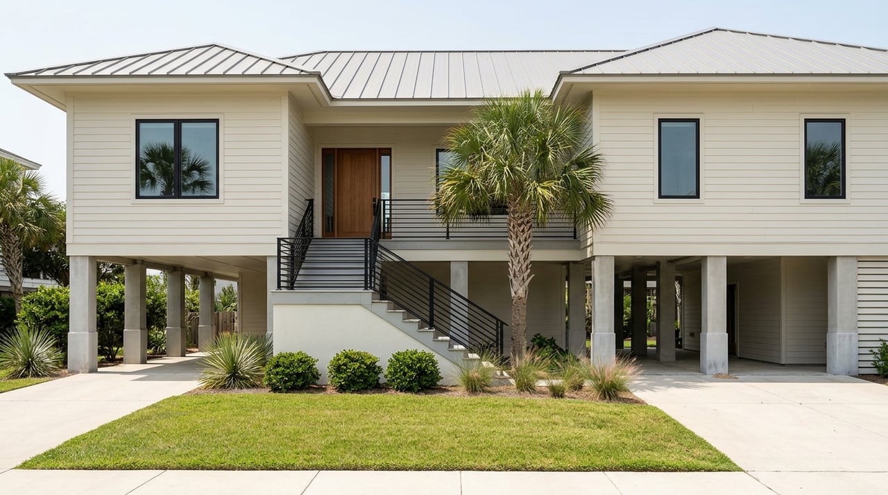
This is not a coincidence of timing. The Spit has decades-old cottages and small apartment buildings built mostly between 1940 and 1969, many of them a block or two from open water, alongside a wave of ground-up construction on streets like Little Bay Avenue, where four new beachfront homes have been under construction or breaking ground within the same stretch of blocks. Buyers shopping the low end are usually buying older, flood-exposed square footage. Buyers shopping the high end are usually buying homes built to current elevation standards, with the price to match.
Why the Median Moves by Six Figures in a Single Report
When a housing stock is this split, the median is not a stable measure of value. It is a snapshot of whatever happened to close that month. A quiet month where three older condos sell will drag the average down. A month where two new waterfront builds close will pull the median up. Neither movement means anyone's home actually gained or lost value. It means the mix of what sold changed.
That is exactly the pattern in the numbers. One report showed the average sale price down more than 30 percent year over year for a single recent month, while the three-month period ending in June 2026 showed the median up 16 percent over the same window a year earlier. Homes were also selling faster, in an average of 24 days compared to 30 days the year before, with 11 sales in June 2026 against 9 the year before. Read as a single trend line, those numbers look erratic. Read as evidence of a bimodal market, they make sense: a small, active pool of buyers is willing to pay new-construction prices for elevated waterfront homes, and whenever a few of those close in the same window, the median jumps, whether or not underlying values moved at all.
Here is a simplified picture of the split, drawn from the listing data and agent commentary in current circulation:
| Older Willoughby stock | New Willoughby construction | |
|---|---|---|
| Typical era built | 1940s to 1960s | 2024 to present |
| Price range seen | $165,000 to low $300,000s | $700,000 to $1,429,000 |
| Flood exposure | Higher, pre-dates current elevation codes | Built to current elevation standards |
| What moves the median | Drags it down when several sell in a month | Pulls it up sharply when even one or two close |
The City Just Changed the Long-Term Math
The reason this split matters more now than it did a year ago is that Norfolk is actively working to close the gap on the older side of the stock, not by letting those homes catch up in price, but by physically lifting some of them out of flood risk.
In January 2026, Norfolk secured an additional $25 million in state funding to support its long-running Coastal Storm Risk Management project, developed with the U.S. Army Corps of Engineers. Kyle Spencer, Norfolk's chief resilience officer, told WHRO that the city is starting with 62 homes deemed most at risk on Willoughby Spit, out of roughly 275 properties on the peninsula identified in an earlier feasibility study. By June, the scope was confirmed at nearly $50 million in total project value, built on a $24.9 million grant from Virginia's Community Flood Preparedness Fund that requires a dollar-for-dollar local match. The grant agreement took effect April 1, 2026, with work required to begin within nine months and finish within three years.
The mechanics matter for anyone pricing property here. According to reporting on the program, participation is voluntary, and the city is covering 100 percent of the cost of elevating a home or filling in a basement, with no out-of-pocket contribution from the homeowner. That is a meaningfully different structure than the standard FEMA hazard mitigation grant, which typically requires the property owner to cover 10 to 25 percent of the cost. The city has also committed to covering relocation costs, including hotel stays, while a home is physically being lifted. Outreach began with the Willoughby Civic League in February 2026, and by mid-April roughly 20 homeowners in the pilot cohort had started applications.
What this means in practice: some of the older, lower-priced homes on Willoughby Spit are on a path to being elevated at no cost to their owners, which removes a meaningful piece of the flood exposure that currently separates them from the new-construction end of the market. Others, outside the initial 62-home cohort, are not. Two homes that look similar on paper today, both built in the 1950s, both a similar distance from the water, could diverge sharply in flood risk and insurability over the next three years depending on whether they landed in this first tier.
That is on top of a separate, citywide question. FEMA is expected to update its flood insurance rate maps for Norfolk, and any property currently outside a mandatory flood zone could be redesignated once new maps take effect. A home that pencils out financially today, on either side of Willoughby's price split, could look different once remapping and mandatory insurance requirements are factored in.
What to Check Before You Compare Prices
If Willoughby Spit is on your list, the neighborhood median is a starting point, not a conclusion. Before comparing a specific listing to anything you have seen on a portal, it is worth confirming a few things directly:
- Pull the current FEMA flood zone designation for the specific address, not the neighborhood average, through Norfolk's public flood risk lookup tool.
- Ask whether the property has an elevation certificate on file, and how recent it is. An elevation certificate can lower a flood insurance premium by hundreds of dollars a year, and its absence is worth a direct question to the seller.
- Ask specifically whether the home is part of the city's 62-home pilot cohort for the elevation program, or whether it falls within the broader 275-property study area that may be eligible in a later phase.
- Compare year built and construction elevation, not just square footage and finishes, when weighing a lower-priced listing against a newer one.
Common Questions
Is all of Willoughby Spit in a flood zone? Flood zone designations vary by specific address and elevation, not by neighborhood as a whole. A property's current designation reflects today's maps, and Norfolk's citywide remapping effort could change designations for some properties before it changes them for others.
Does the city's elevation program cost the homeowner anything? Based on public reporting on the program, participation is voluntary and the city is covering the full cost of qualifying elevation or basement-fill work for homes in the initial cohort, including relocation assistance during construction.
Will flood insurance premiums definitely go up? Not for every property. Premiums depend on a home's specific flood zone, elevation, and whether it has a current elevation certificate. A home moved out of a high-risk designation through the city's program could see costs go down rather than up.
Willoughby Spit rewards buyers who ask about the specific parcel, not the neighborhood-wide number. If you are weighing this stretch of bayfront against other Hampton Roads waterfront options, or trying to make sense of a listing that does not match the median you saw online, Jack Blake can walk through the flood zone status, elevation history, and pricing context for a specific address before you make a decision. Reach out for a free home valuation and a straight read on where a property actually stands.